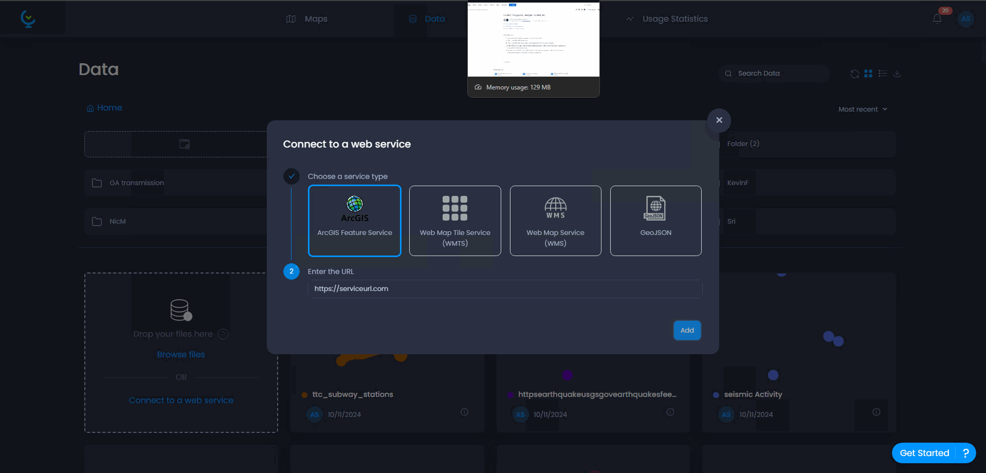
CartoVista supports not only the uploading of local files, such as data tables, vector layers, and raster layers, but also allows users to add web services layers like ESRI ArcGIS Feature Services, WMS, WMTS, and GeoJSON data.
The process is simple, and straight forward:
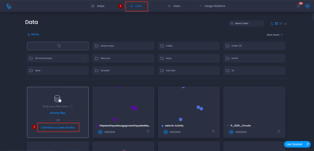
- Open the Data tab, and click on Connect to Web Service, this can also be done within a Map
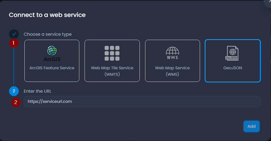
2. Select the appropriate Web Service (e.g., ESRI Feature Services) you would like to import, and enter the URL and click Add
Sample walkthrough of importing an ESRI Feature Service Layer